Current weather and runoff data
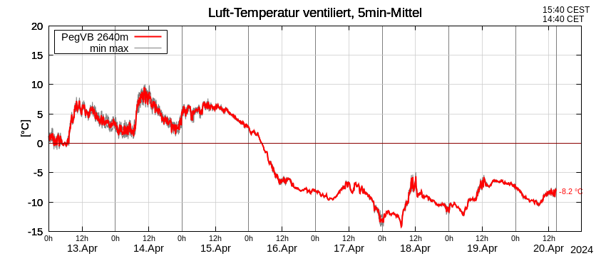
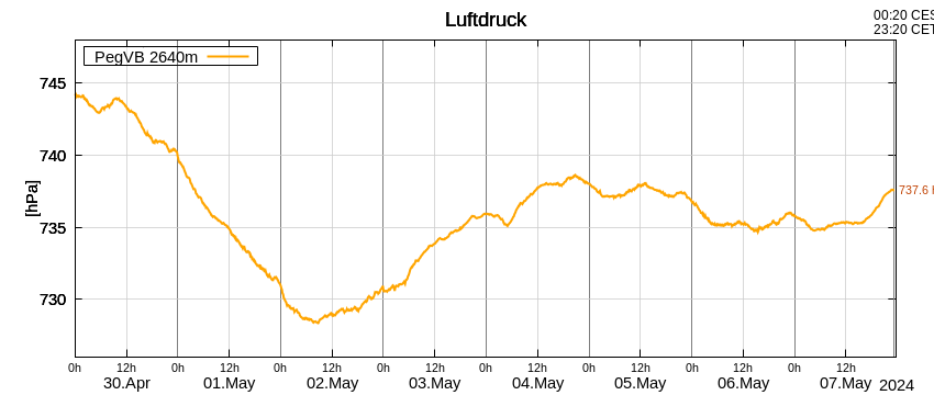
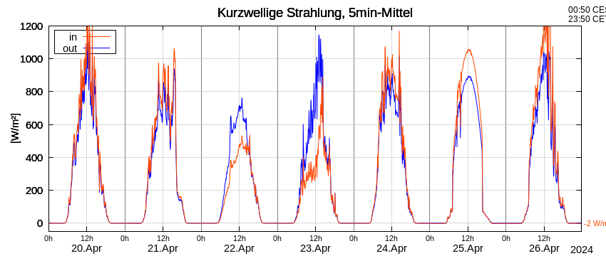
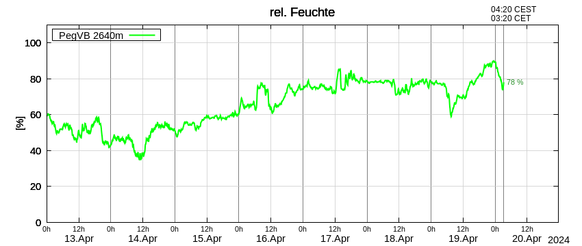
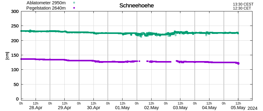
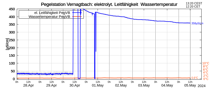
At the Vernagtbach gauging station at 2640 m, about 1.5 km below the glacier tongue, weather data such as temperature, air pressure, wind speed, precipitation and radiation values as well as the runoff from the Vernagtbach stream have been recorded since the 1970s. Thus, the gauging station is likely to be the highest permanently operated runoff measuring station in the Alps. At the “Ablatometer” station installed directly on the ice of Vernagtferner at 2950 m, ice ablation and snow depth are additionally measured. The following diagrams are created from raw data and are updated every 10 minutes. After cleansing, the data will be archived to the scientific platform PANGAEA, a geoscientific database hosted by AWI and MARUM, where they will be accessible to the general public. The runoff data are also included in Hydrographische Jahrbuch von Österreich (Hydrographic Yearbook of Austria).